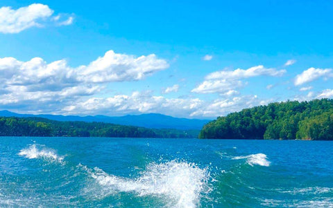
Lake Keowee, South Carolina!
Our beautifully detailed, laser engraved and precision cut map of Lake Keowee in Oconee County, South Carolina with the following interesting stats carved into it:Surface Area: 28.91 Square Miles
Surface Elevation: 800 Feet
Length: 26.1 Miles
Average Depth: 54 Feet
Lake Keowee is a man-made reservoir in the United States in the state of South Carolina.
It was created to serve the needs of a power utility (Duke Energy) as well as public recreational purposes.
It began in 1971 as a massive demolition and building project, including the construction of two large dams––Keowee Dam and Little River Dam––and covered 18,372 acres (74.35 km2) of the state.
The lake collects or impounds waters from the Keowee River and the Little River and others, and the outflows below the respective dams join to form the Seneca River which flows into the larger Savannah River.
Lake water helps to cool Duke Energy's three nuclear reactors located at the Oconee Nuclear Generating Station.
In addition, the force of falling water through gravity helps generate hydroelectric power.
The Keowee Hydro Station generates 158 megawatts from the lake's outflows.
In addition, Lake Keowee has been touted as a recreational destination for fishing, boating, swimming, sailing, kayaking and other watersports, and the lake has been described as having pure and clean water.
The name Keowee (ᎨᎨᎨ) is a Cherokee name roughly translated as "place of the mullberries."
The former Keowee River, which was inundated by Lake Keowee, had been part of the Cherokee Lower Towns region, and Keowee Town had been located on the bank of the Keowee River.
#lakekeowee
#oconeecounty
#SouthCarolina
#unitedstates
#dukeenergy
#keoweedam
#littleriverdam
#senecariver
#savannahriver
#oconeenucleargeneratingstation
#keoweehydrostation
#cherokeelowertowns
#keoweetown
#keoweeriver
#personalhandcrafteddisplays
#phds4u
#DoctorsOfDisplays
🌊🌤