Cape Coral, Florida!
This is our gorgeously detailed, laser engraved and precision cut topographical Map of Cape Coral in Lee County, Florida with the following interesting stats carved into it:
“Waterfront Wonderland”
Founded in 1957 with 120 square miles of land and water.
Over 400 miles of navigable waterways.
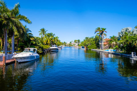
More miles of canals than any other city in the world.
Cape Coral is a city located in Lee County, Florida, United States, on the Gulf of Mexico.
Founded in 1957 and developed as a master-planned, pre-platted community, the city grew to a population of 154,305 by the year 2010.
With an area of 120 square miles, Cape Coral is the largest city between Tampa and Miami.
It is a principal city in the Cape Coral – Fort Myers, Florida Metropolitan Statistical Area. The population estimate for the statistical area was 645,899 for 2009.
The city is known as a "Waterfront Wonderland", since with over 400 miles of navigable waterways, Cape Coral has more miles of canals than any other city in the world.
#capecoral
#florida
#leecounty
#gulfofmexico
#floridacoastalmap
#waterfrontwonderland
#unitedstates
#tampa
#miami
#personalhandcrafteddisplays
#doctorsofdisplays
#phds4u
🏝⛵