
Skip to product information


**Please note: Actual layout may vary based on size. If you'd like to see a proof of the layout prior to production, let us know,


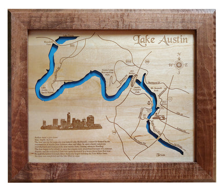
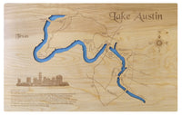
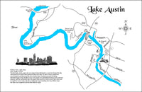
This is a beautiful, detailed, laser engraved and precision cut map, including lake information such as surface area, elevation and maximum depth.
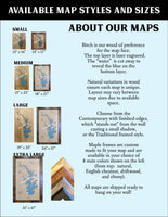
Included With All Maps:
- Points of interest laser engraved into the map face
- A blue, self-adhesive Swarovski crystal to mark your preferred location on the map
Our maps are made from beautiful birch plywood. Natural variances in the wood grain ensure a unique work of art. Once the map is cut, it is hand sanded multiple times, mounted on a blue board to highlight the water, and given a clear coat for a lustrous wood shine. Proudly made in the USA by American workers in an American owned business.
**Please note: Actual layout may vary based on size. If you'd like to see a proof of the layout prior to production, let us know,
Custom Engraving Available
Add up to 2 lines of custom engraving at no additional cost!
Standard Engraving:
- Surface Area: 1,599 Acres
- Depth: 75 Feet
The first lake on the same site was named Lake McDonald, a reservoir formed by the construction of Austin Dam between 1890 and 1893. In 1900 a heavy rainstorm overwhelmed and destroyed the first Austin Dam, causing extensive flooding. The dam began to be rebuilt in 1915, but repairs were abandoned because of a contract dispute, and the unfinished dam was again destroyed in a heavy storm later that year. In 1938 the Lower Colorado River Authority began building the Tom Miller Dam; the dam was completed and the lake filled in 1939.