
Skip to product information
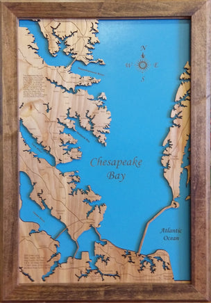
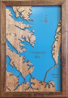

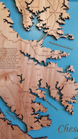


This is a beautiful, detailed, laser engraved and precision cut map, including lake information such as surface area, elevation and maximum depth.
Included With All Maps:
- Points of interest laser engraved into the map face
- A blue, self-adhesive Swarovski crystal to mark your preferred location on the map
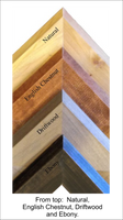
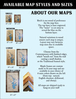
Our maps are made from beautiful birch plywood. Natural variances in the wood grain ensure a unique work of art. Once the map is cut, it is hand sanded multiple times, mounted on a blue board to highlight the water, and given a clear coat for a lustrous wood shine. Proudly made in the USA by American workers in an American owned business.
Custom Engraving Available
Add up to 2 lines of custom engraving at no additional cost!
Standard Engraving:
- The Chesapeake Bay is an estuary lying inland from the Atlantic Ocean surrounded by the states of Maryland and Virginia, the largest body of water in the US. More than 150 rivers and streams flow into the bay’s 64,299 sq. miles drainage basin, which covers parts of six states (New York, Pennsylvania, Delaware, Maryland, Virginia and West Virginia) and the District of Columbia.
- 200 miles long
- Max. depth: 208 feet
- Avg. depth: 46 feet
- 2.8 to 30 miles wide
- 11.684 miles of shoreline
- Surface area 4,479 sq. miles