
Skip to product information


**Please note: Actual layout may vary based on size. If you'd like to see a proof of the layout prior to production, let us know,


This is a beautiful, detailed, laser engraved and precision cut map, including lake information such as surface area, elevation and maximum depth.
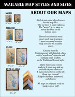
Included With All Maps:
- Points of interest laser engraved into the map face
- A blue, self-adhesive Swarovski crystal to mark your preferred location on the map
Our maps are made from beautiful birch plywood. Natural variances in the wood grain ensure a unique work of art. Once the map is cut, it is hand sanded multiple times, mounted on a blue board to highlight the water, and given a clear coat for a lustrous wood shine. Proudly made in the USA by American workers in an American owned business.
**Please note: Actual layout may vary based on size. If you'd like to see a proof of the layout prior to production, let us know,
Custom Engraving Available
Add up to 2 lines of custom engraving at no additional cost!
Standard Engraving:
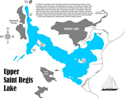
- Surface Area: 742 Acres
- In 1899, the members of the St. Regis Yacht Club commissioned Clinton Crane to design a class of wooden sailing sloops for racing on the Upper St. Regis Lake. A few members contracted to purchase the first of these boats, which were to be called Idems (Latin for same), and to sail them annually in competition. Over the next few years more club members contracted for these sleek vessels until there were an even dozen boats whose sails would catch the wind each summer as they competed. Today, these same twelve, unique sloops continue this racing tradition — some even skippered by descendants of those original owners.