
Skip to product information
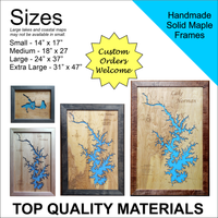

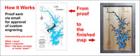
**Please note: Actual layout may vary based on size. If you'd like to see a proof of the layout prior to production, let us know,
The river is generally quite shallow, and it briefly dips below ground in some areas in the Hill Country. As with many of the rivers in the Texas Hill Country, there is great variability in the Blanco River's flow. The mean flow is 93 ft³/s (3 m³/s), but heavy rains in the river's watershed can cause flash flooding with little warning.


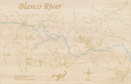
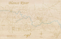
This is a beautiful, detailed, laser engraved and precision cut map, including lake information such as surface area, elevation and maximum depth.
Included With All Maps:
- Points of interest laser engraved into the map face
- A blue, self-adhesive Swarovski crystal to mark your preferred location on the map
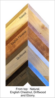
Our maps are made from beautiful birch plywood. Natural variances in the wood grain ensure a unique work of art. Once the map is cut, it is hand sanded multiple times, mounted on a blue board to highlight the water, and given a clear coat for a lustrous wood shine. Proudly made in the USA by American workers in an American owned business.
**Please note: Actual layout may vary based on size. If you'd like to see a proof of the layout prior to production, let us know,
Custom Engraving Available
Add up to 2 lines of custom engraving at no additional cost!
- Surface Elevation: 1,607 Feet
- Length: 87 Miles
- Basin Size: 412 Square Miles
The river is generally quite shallow, and it briefly dips below ground in some areas in the Hill Country. As with many of the rivers in the Texas Hill Country, there is great variability in the Blanco River's flow. The mean flow is 93 ft³/s (3 m³/s), but heavy rains in the river's watershed can cause flash flooding with little warning.