
Skip to product information


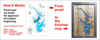

**Please note: Actual layout may vary based on size. If you'd like to see a proof of the layout prior to production, let us know,


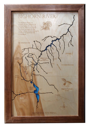
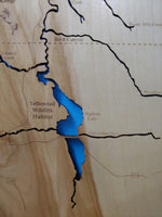
This is a beautiful, detailed, laser engraved and precision cut map, including lake information such as surface area, elevation and maximum depth.
Included With All Maps:
- Points of interest laser engraved into the map face
- A blue, self-adhesive Swarovski crystal to mark your preferred location on the map
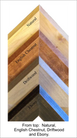
Our maps are made from beautiful birch plywood. Natural variances in the wood grain ensure a unique work of art. Once the map is cut, it is hand sanded multiple times, mounted on a blue board to highlight the water, and given a clear coat for a lustrous wood shine. Proudly made in the USA by American workers in an American owned business.
**Please note: Actual layout may vary based on size. If you'd like to see a proof of the layout prior to production, let us know,
Custom Engraving Available
Add up to 2 lines of custom engraving at no additional cost!
- 5,574 Surface Acres
- Elevation: 3,303 Feet
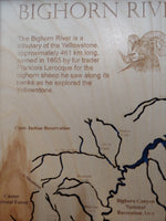
The 525-foot-high Yellowtail Dam impounds the Bighorn River at Fort Smith, Montana. Completed in 1965 Yellowtail Dam changed a good warm water fishery into a high quality tail-water trout fishery below the dam. Its construction created Bighorn Lake which lies between the Bighorn and Pryor Mountains by the Bighorn River. Hundreds of feet down, within the Bighorn Canyon, water is backed up some 41 miles in Montana and 30 miles into Wyoming.