
Skip to product information
**Please note: Actual layout may vary based on size. If you'd like to see a proof of the layout prior to production, let us know,


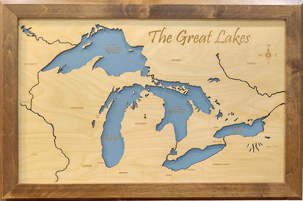
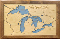
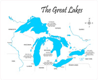
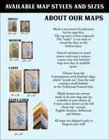
This is a beautiful, detailed, laser engraved and precision cut map, including lake information such as surface area, elevation and maximum depth.
Included With All Maps:
- Points of interest laser engraved into the map face
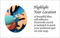
- A blue, self-adhesive Swarovski crystal to mark your preferred location on the map
Our maps are made from beautiful birch plywood. Natural variances in the wood grain ensure a unique work of art. Once the map is cut, it is hand sanded multiple times, mounted on a blue board to highlight the water, and given a clear coat for a lustrous wood shine. Proudly made in the USA by American workers in an American owned business.
**Please note: Actual layout may vary based on size. If you'd like to see a proof of the layout prior to production, let us know,
Custom Engraving Available
Add up to 2 lines of custom engraving at no additional cost!
Standard Engraving:
SUPERIOR: Area 31,700 Sq Miles
Surface Elevation: 591 Feet
Mean Depth: 483 Feet
Length: 349.8 Miles
HURON: Area: 23,012 Sq Miles
Surface Elevation: 581 Feet
Mean Depth: 195 Feet
MICHIGAN: Area: 22,394 Sq Miles
Surface Elevation: 577 Feet
Length: 307 Feet
ERIE: Area: 9,940 Sq Miles
Mean Depth: 62 Feet
Surface Elevation: 571 Feet
ONTARIO: Area: 7,320 Sq Miles
Surface Elevation: 243 Feet
Length: 193 Feet
Mean Depth: 283 Feet